Water Quality Network
The Pennsylvania Water Quality Network (WQN) is a statewide, fixed station water quality sampling system operated by the Department of Environmental Protection's (DEP) Bureau of Clean Water. It is designed to assess both the quality of Pennsylvania's surface waters and the effectiveness of the water quality management program by accomplishing four basic objectives:
- Monitor temporal water quality trends in major streams throughout the Commonwealth of Pennsylvania
- Monitor temporal water quality trends in selected reference waters
- Monitor the trends of nutrient and sediment loads in the major tributaries entering the Chesapeake Bay
- Monitor temporal water quality trends in selected Pennsylvania lakes
Major streams, for the purposes of this Network, are interstate and intrastate waters with drainage areas of roughly 200 square miles or greater. These waters receive both point and non-point source pollutants and are sampled at or near their mouths to measure overall quality before flows enter the next higher order stream or before exiting the state. In this way, trends can be established and the effectiveness of water quality management programs can be assessed by watershed.
WQN Stations
The WQN is comprised of three primary station types: standard, Chesapeake Bay nutrient loading (Chesapeake Bay), and reference.
- Standard stations are generally sampled every other month for stream discharge measurements and physical/chemical analysis and annually for a biological evaluation.
- The Chesapeake Bay stations are sampled monthly for stream discharge measurements and physical/chemical analysis, and every other year for a biological evaluation. In addition to the monthly samples, these stations are sampled 8 additional times per year during storm events.
- Reference stations are sampled monthly for stream discharge measurements and physical/chemical analysis and once a year (spring or fall) for a biological evaluation.
- In addition, 15-20 lakes are sampled once a year for physical/chemical analysis for five consecutive years before initiating a new group. The 5-year data blocks are then used to assess lake water quality trends.
Reference stations are selected to represent minimally disturbed waters within Pennsylvania’s various bioregions. Although it may be argued that Pennsylvania has no unaffected waters (by atmospheric deposition), reference stations reasonably describe water quality that could be achieved in the absence of point source discharges and in the presence of minimal or typical non-point source impacts. Thus, these stations can provide, in the absence of site specific data, a benchmark for use in the water quality management permitting program as well as a measure of changing water quality in areas of the state not directly impacted by development.
Lakes included in the WQN (except for Lake Erie and Presque Isle Bay which are part of the stream sampling network) are selected after consideration of size, public access, intensity of use and availability of existing data. Large lakes with heavy public use and/or historical data are favored for inclusion in this program because changing trends in the water quality of these resources have the potential for serious impacts on water uses.
Data Collection and Reporting
Data collection is a collaborative effort between the United States Geological Survey (USGS) PA Water Science Center, Susquehanna River Basin Commission (SRBC), and Pennsylvania Department of Environmental Protection (PADEP). The data collected at these stations can be viewed and downloaded from the Water Quality Portal. The water chemistry data collected at the Chesapeake Bay stations is also downloadable from the Chesapeake Bay Program (CBP) Water Quality Database. Reporting on WQN data can be found in the USGS Annual Data Reports, SRBC Technical Reports, the SRBC Sediment and Nutrient Assessment Program (SNAP) Reports, and in the PADEP Integrated Water Quality Monitoring and Assessment Report. WQN station locational information and descriptions of the physical, chemical, and biological data to be collected is published in Pennsylvania’s Surface Water Quality Network (WQN) manual. This manual can be found in Appendix D of PADEP'S Water Quality Monitoring Protocols for Streams and Rivers document. Detailed lists of the active, discontinued, and macroinvertebrate WQN stations are also included in the manual. Links to the manual, databases, and reports can be found below under the Resources section of this webpage.
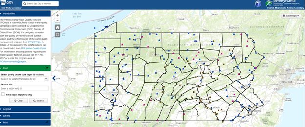
WQN Web Application
This GIS-based application allows users to spatially view the WQN stations. The active, discontinued, and macroinvertebrate stations can be viewed and station information can be identified by clicking on the station.
http://www.depgis.state.pa.us/WQN/
Resources
For information and/or questions regarding the Water Quality Network contact the Water Quality Division at 717.787.9637.