 The Issue
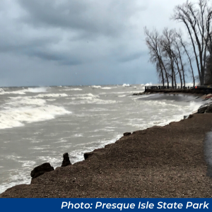
Water levels in the North American Great Lakes have been at or above monthly record highs for much of 2019 and 2020. Lakes Superior, Erie, and Ontario each reached all-time record levels in July 2019 and set monthly records for the first half of 2020. All of the Great Lakes remain well above their long-term averages.
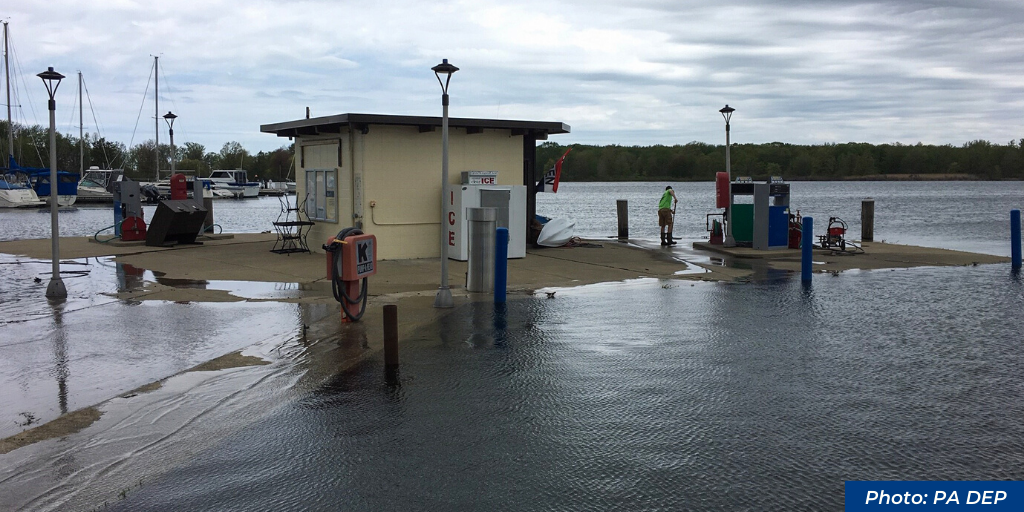
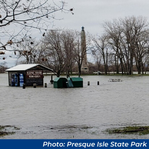
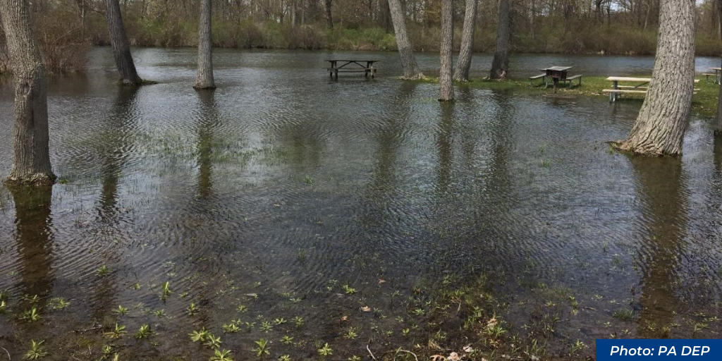
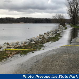
High water levels have resulted in increased shoreline erosion during storm events, flooded roadways, and coastal property damage. High water levels have been particularly problematic for Presque Isle State Park—the most visited state park in the Commonwealth. High water levels have amplified beach erosion during storms, have damaged park marinas, and have resulted in the temporary closing of roadways, trails, and facilities. High water levels aren’t all bad news, however. They have increased spawning habitat for some species of fishes and have made navigation channels deeper to the benefit of commercial shipping and recreational boating.
The Cause
 Unlike rising sea levels, which are caused primarily by runoff from melting polar ice sheets and warming expanding ocean waters—water levels in the Great Lakes are a result of the difference between precipitation (rainfall and snowfall) in the lake basin and evaporation of water from the surface of the lakes. During wet years water levels tend to be higher and during dry years they tend to be lower. The Great Lakes are all interconnected, with water flowing downgradient from massive Lake Superior through the other Great Lakes and ultimately to the Atlantic Ocean via the St. Lawrence Seaway. As a result, water levels in the lower lakes are strongly influenced by inflow and weather conditions in the upper Great Lakes basin.
Predicting Future Water Levels
While global sea levels have been steadily increasing for over 100 years, long-term water level trends in the Great Lakes are much more changeable and difficult to predict. Water levels fluctuate predictably on a seasonal basis, with seasonal lows occurring in the winter and seasonal highs later in the summer. Year-to-year fluctuations, however, are much less predictable. In fact, only seven years ago in 2013, water levels in Lakes Huron and Michigan were at record low levels! The US Army Corps of Engineers, which monitors and forecasts water levels in the Great Lakes, reports that monthly mean water levels continue to be near or above record high levels across the Great Lakes.
Water Level Regulation in Lake Erie
It may be surprising to some readers that there is no way to regulate water levels in Lake Erie—Pennsylvania’s Great Lake. While some water level regulation is possible in Lakes Superior and Ontario, Lake Erie’s water ultimately plunges over Niagara Falls on its way downstream to Lake Ontario and then the Atlantic Ocean. A portion of this water is used to generate electricity for the United States and Canada, but nothing can stop its relentless run towards the sea. Water levels in Lake Erie will largely remain at the mercy of weather conditions in the upper lakes. As these conditions change, so too will the need for shoreline residents to adapt.
Protecting the Resource—PA’s Coastal Resources Management
For nearly 40 years, the DEP’s Coastal Resources Management Program (CRMP) has worked with property owners, municipal governments, scientists, engineers, and others to understand and address the effects of fluctuating lake levels on the shoreline. While Lake Erie is a particularly difficult environment in which to work because of its shallow depth and high wave energy environment, coastal staff are gaining a better understanding of how offshore factors affect the natural onshore processes such as erosion. Ultimately, the goal is to develop shoreline protection systems that work with these factors, rather than trying to keep them at bay.
 The Program is also looking more closely at land-based inputs, such as illicit discharges and damaged riparian buffer zones, to determine if erosion can be controlled by modulating the volume of water entering the lake through the bluffs. A side benefit will be to determine whether or not these systems contribute nutrient and sediment loads in Lake Erie. Reducing both is a primary goal of the Great Lakes Sedimentation and Nutrient Reduction Program, of which the CRMP is a supporting member.
Program staff provide technical assistance to property owners at all levels, either one-on-one, or through the agency’s many partners. Given that most of the properties in the Lake Erie Coastal Zone are privately owned, the program focuses much of its efforts on landowner education. By taking simple steps such as creating a no-mow buffer zone at the edge of the bluff, eliminating impervious surfaces, managing stormwater runoff, minimizing water usage (what goes down the drain comes out the bluff), and keeping shade canopies intact, property owners can proactively help protect their bluff properties.
The program also works with local governments and municipalities to implement and enforce zoning ordinances and development setbacks, manage stormwater systems, and monitor the bluff for any building violations that can lead to bluff failures.
Much like the ever-changing water levels, DEP continues to adapt its protection of the Lake Erie shoreline to ensure its longevity.