Recognizing the need to preserve and consolidate mine map collections, the Pennsylvania Department of Environmental Protection (DEP) has converted over 63,000 paper mining maps to digital format in order to make mining safer, and government more efficient.
Mining in Pennsylvania: A Brief History
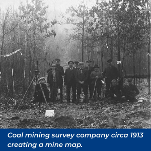 Pennsylvania has a long and rich coal mining history dating back to the 1700s. Anthracite, or hard coal, was mined in the eastern part of the state as early as 1775, while bituminous, or soft coal, was mined in Western Pennsylvania beginning around 1760. Ever since, Pennsylvania coal has been used to generate power, heat homes, and produce steel among other uses. Pennsylvania coal helped power the Industrial Revolution and helped the United States win two World Wars.
While mining activity in Pennsylvania peaked during the early 20th century, there are still over 40 underground mines actively mining coal in Pennsylvania as well as 5,000 or more abandoned underground mines across the state. With so many mining sites scattered across the state, mine maps are vitally important to not just the mining industry, but also to the construction industry, homeowners, emergency responders and various other stakeholders.
Mine Maps
Mine maps show underground mine workings such as the locations of tunnels, shafts, seams and veins and also various surface features such as roads and buildings. The maps were created as mining took place, allowing miners to both know where they were going, and to help develop a plan to remove the coal from the mine. Pennsylvania’s mining laws have required some form of mine mapping since 1885 for bituminous coal mines and since 1870 for anthracite coal mines, but it’s believed that mapping of Pennsylvania’s anthracite mines started as early as the 1850’s. Early maps were made from a variety of materials including paper, cloth, canvas, velum and mylar.
 Over time, mining maps became scattered over various public and private sources. Storage conditions ranged from poor to archival. Many maps were damaged, and many others lost over the decades. Members of the mining industry recognized the need to have a centralized location for maps and to be able to provide public and industry access to them. Efforts to do so gained momentum rapidly after the events of July 24, 2002.
The Quecreek Mine Incident Dramatically Illustrates the Need for Accurate Mine Maps
The need for accurate mine mapping is important and increases in importance as mining activity approaches potential hazards. On July 24, 2002, miners from the Quecreek Mining Company in Somerset County, Pennsylvania drilled into a long-abandoned adjacent mine causing an estimated 50 to 60 million gallons of water to flood the section of mine that they were working in. Nine miners were trapped underground for four days. Tragedy was averted when all were successfully rescued. An investigation by the Mine Safety and Health Administration into the incident determined that the cause of the accident was the unavailability of a certified final mine map for the adjacent mine.
 While the process of restoring and digitizing mine maps had already been underway, the Quecreek incident prompted increased action for collecting, maintaining, documenting, and making available old mining records and maps. On September 4, 2002, then Pennsylvania Governor Mark Schweiker established the Commission on Abandoned Mine Voids and Mine Safety. Among the Commission’s recommendations:
- Designate a single Commonwealth agency (DEP) as the ‘official keeper’ of mine maps.
- Assess the proper technology and methodologies to digitally store and georeference mine maps.
- Complete cataloging of all maps contained within the state system into a database and cross-reference to production records maintained by the Commonwealth. Initiate a joint project between DEP, the Pennsylvania Department of Conservation and Natural Resources (DCNR) and the Federal Office of Surface Mining (OSM) to ensure that the repository of each agency contains all maps available within Pennsylvania.
- Implement a preservation program including: archival and photographic storage, electronic recording of original mine maps and georeferencing of electronic maps.
Tasked with fulfilling the recommendations of the Commission, DEP workers set out to locate all the final maps submitted to the Department since 1911, catalog and digitize them. They would also need to investigate and research procedures for the preservation and protection of maps to avoid further deterioration.
Accomplishing these tasks would not be easy.
DEP’s Mine Map Plan
Locate the Maps
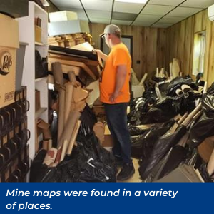
Maps were found in a variety of places, some expected, and some unexpected. Several DEP Mining Offices had collections of maps, while other maps were found in public places such as universities, libraries, and museums. Other sources included mining companies, engineering firms, and private individuals. An extensive collection of maps was received from the children of a mining engineer who had passed away. Still others were retrieved from a school house ready for demolition, while some were recovered from a Pottsville city dumpster.
Restore Them
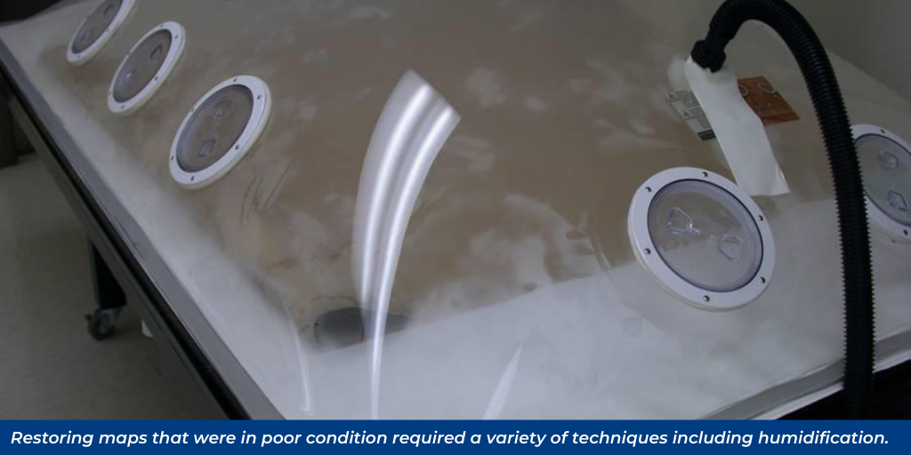
The maps received were in various states of condition due to how and where they were stored. Some of the maps were very delicate and crumbled apart. Other maps were very dirty or stained. Steps that needed to be taken included: restoration, scanning, cataloging, georeferencing and vectorizing. Restoring the maps that were in poor condition required a variety of techniques including: humidification, flattening, dry-cleaning, tape removal and other methods of repair.
Digitize, Scan and Catalog Them
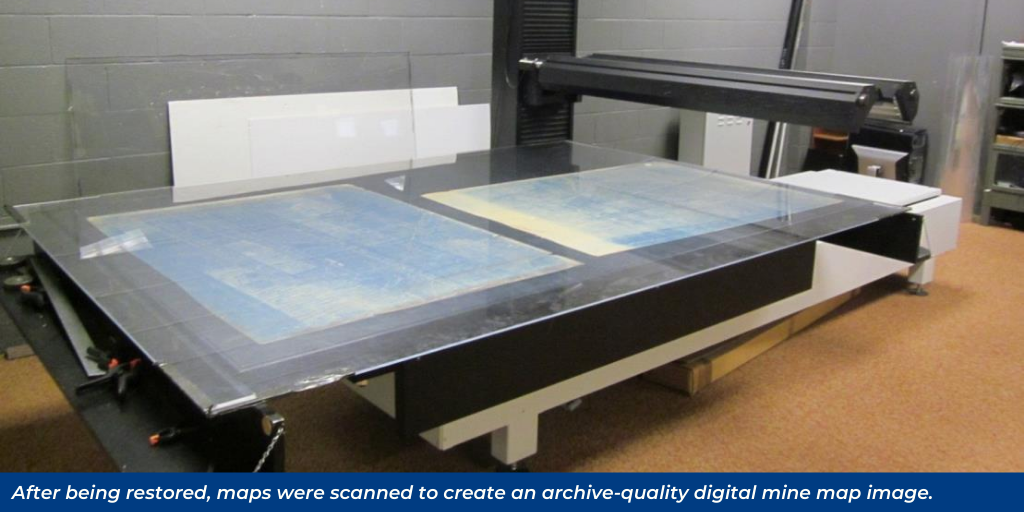
After being restored, the maps were scanned to create an archive-quality digital mine map image. A centralized database named the
Pennsylvania Historic Underground Mine Map Inventory System (PHUMMIS) was created to store the maps as well as other information relevant to past and present underground mining within the Commonwealth of Pennsylvania.
Georeference and Vectorize Them
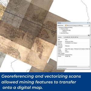 Just as motorists today rely on GPS navigation instead of the paper maps that were once handed out at gas stations, mining now relies on computerized digital mapping. Georeferencing and vectorizing the scans of historic maps allows the mining features recorded in those older mediums to transfer on to a digital map. Georeferencing is the process of aligning geographic data to a known coordinate system so it can be viewed, queried, and analyzed with other geographic data. Vectorization is the conversion of raster data (an array of cell values) to vector data (a series of points, lines, and polygons). 55,312 mine map images have been georeferenced as of 5/8/2020.
Provide Public and Industry Access
In addition to the PHUMMIS database, interested parties can now access information through the
Pennsylvania Mine Map Atlas, the
Pennsylvania Spatial Data Access (PASDA) website, as well as
eMapPA.
Funding and Partners
The Mine Map Grant Program provided funding to learning institutions and incorporated nonprofit organizations to assist with mapping efforts. Partnering with DEP in this project were the University of Pittsburgh’s Archive Services Center, the Pennsylvania State University’s Pennsylvania Spatial Data Access Program (PASDA), Harrisburg University, Harrisburg Area Community College, Indiana University of PA, Saint Vincent College and the Eastern PA Coalition for Abandoned Mine Reclamation (EPCAMR).
Benefits of This Project
There are many benefits that have come from this project, none more important than safety. Mining is and has always been a dangerous activity. From 1870 through 2018, over 51,000 Pennsylvania miners lost their lives in mining accidents. The availability of high quality mine mapping data and information has allowed for more effective mine safety and emergency response procedures. Today, more than 3,700 men and women go to work every day in underground mines to help Pennsylvania meet its energy needs. The motto of Pennsylvania miners is: “Safety First, No Shortcuts!” and this endeavor has contributed greatly to that goal and will continue to do so for many years to come. The results of this project will also help save lives and property in non-mining incidents as well.
This project has helped make government more efficient by allowing for timelier permitting and quicker response to public information requests. The availability and easy access to mining information has benefited not just the mining industry, which can use the mine map inventory to research locations for new mining operations and mine reclamation projects, but also the oil and gas industry as well as overall infrastructure development in the commonwealth.
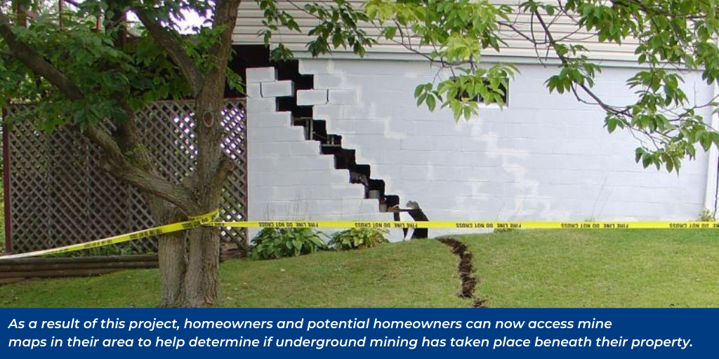
Pennsylvania homeowners have also benefited from the mine map repository by being able to determine if underground mining has taken place beneath their property. More than a million structures in Pennsylvania may be located over old, abandoned underground coal and clay mines. As a result of this project, homeowners and potential homeowners can now access mine maps in their area to help determine their level of risk of property damage. A mine subsidence near one’s property can cause substantial damage and is something that is usually not covered by normal home owner’s insurance.
DEP’s Mine Subsidence Insurance Program provides low-cost protection to property owners against mine subsidence damage to their property.
The digitized maps preserve and document the history of work that Pennsylvania’s coal miners have accomplished over a period of 150 years. This information has now been preserved for future generations thanks to the efforts of DEP’s Mining staff and their partners.
Please contact us at
EP-CSR@pa.gov if you know the location of any mine map collection.