New Program Initiatives and Technical Projects
The Coastal Resources Management Program continually implements new initiatives and conducts technical projects as needed to advance program policies. Below are summaries of ongoing and completed projects in the coastal zones.
Exploring Coastal Zone Boundary Expansion
Coastal areas have unique characteristics that make them economically and naturally vibrant areas. They are also linked to areas outside the coastal zones which can impact coastal resources in both positive and negative ways. Increasingly popular public access sites and trail networks, migratory fisheries, nonpoint source pollution from runoff, and coastal hazards are some examples of how areas outside our current coastal areas can impact the coasts. A changing climate also impacts these connections. In the coming months the coastal program will be evaluating if a larger coastal zone management area would allow for better management of coastal resources, and if so what an expanded area might look like. In the coming months the coastal program will be evaluating if a larger coastal zone management area would allow for better management of coastal resources, and if so what an expanded area might look like. As always we will consider input from our local partners and local stakeholders as we evaluate options for potential expansion.
Qualitative Survey of the Spatial Extent of Freshwater Mussel Beds in the Pennsylvania Portion of the Tidal Delaware River using Side Scan Sonar Imaging and Underwater Video
Freshwater mussels are imperiled throughout Pennsylvania. Current efforts are underway to reestablish mussel populations in watersheds where their populations are severely impaired or where they are thought to be extirpated. As recently as 2017, the full spatial extent of freshwater mussels in the Delaware Estuary was largely unknown. These populations were at increased risk of disturbance from human activity had their distribution remained unknown to Federal and state natural resources agencies.
Remote sensing technologies can allow for very broad spatial coverage to document the locations and extents of existing, potentially unknown mussel populations with a small crew and in a relatively short time-period. This project provided a baseline estimate of the current spatial extent of freshwater mussels in Pennsylvania’s portion of the tidal Delaware River using georeferenced side scan sonar hydroacoustic imaging techniques with site-specific underwater video confirmation. A final spatial dataset and supporting information documenting the Delaware Estuary freshwater mussel population is available upon request to state, federal, and local environmental resource agencies and federally recognized National Estuary Programs (NEPs). A publicly available report is available for download from the DEP eLibrary.
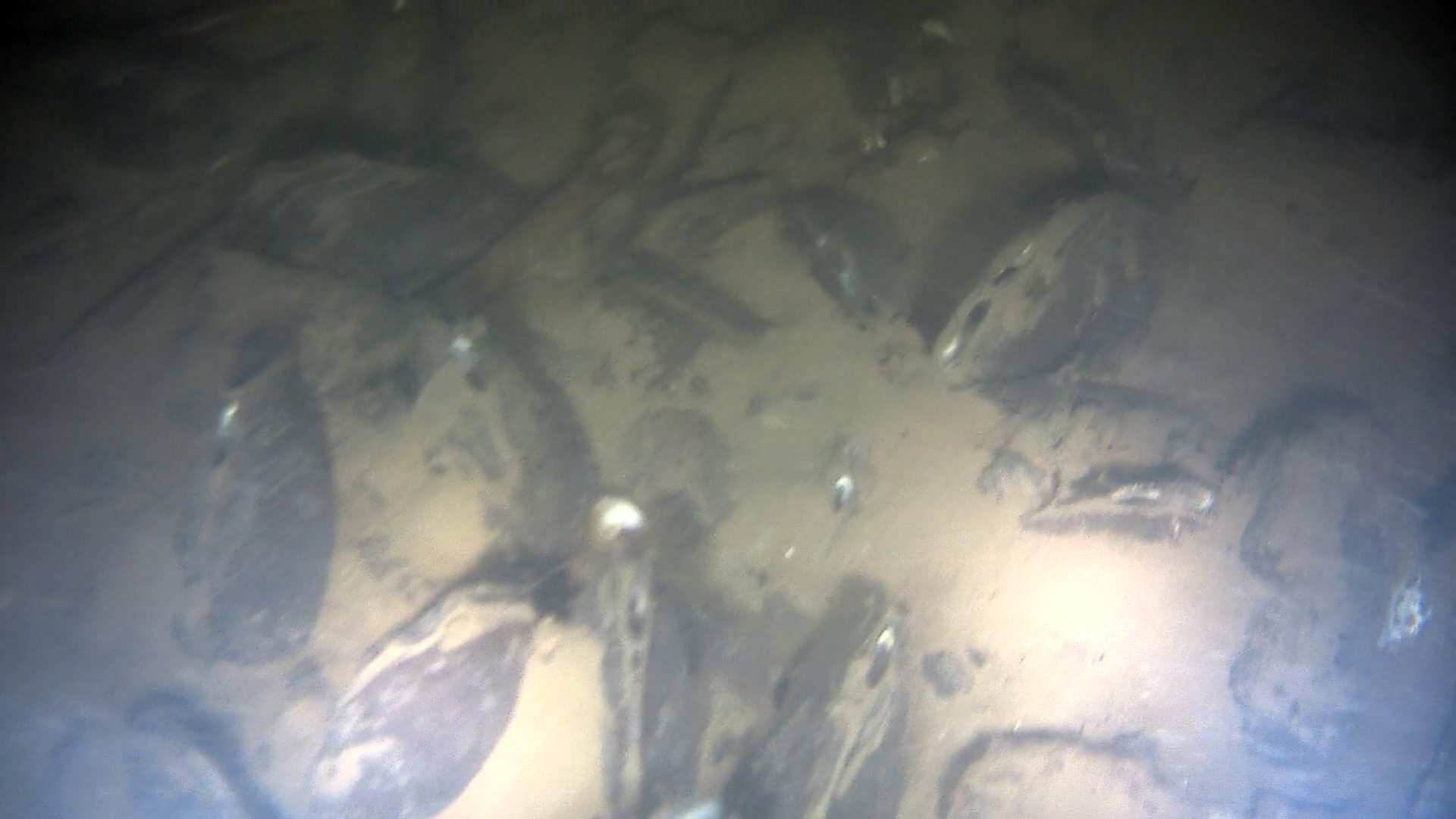
Lake Erie Shipwreck Documentation
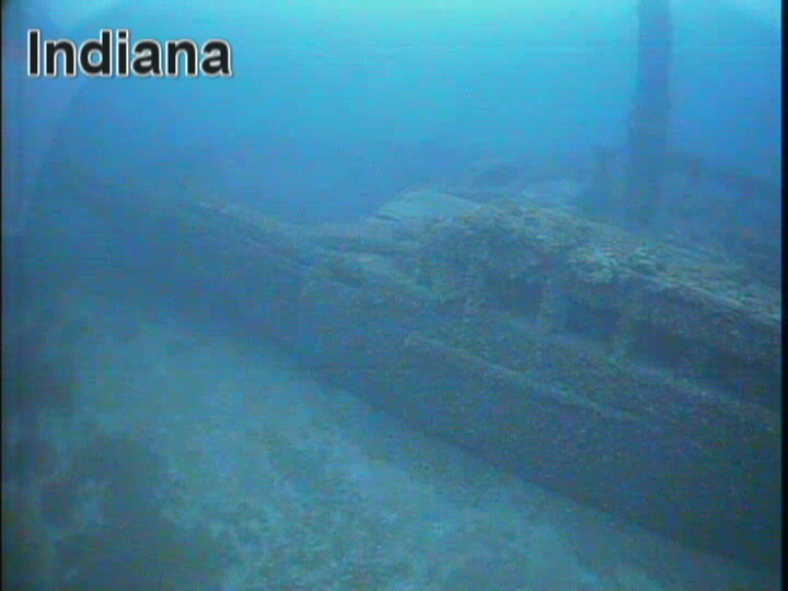
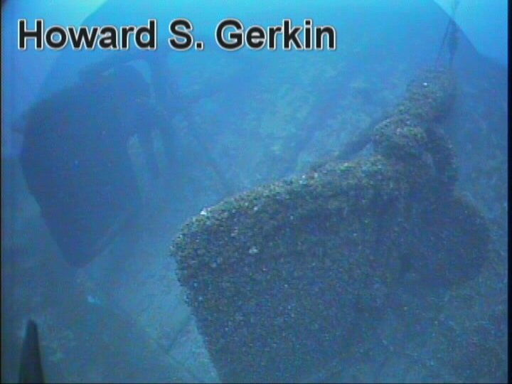
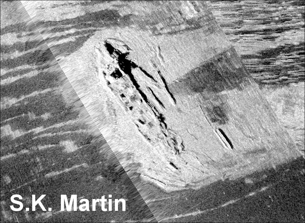
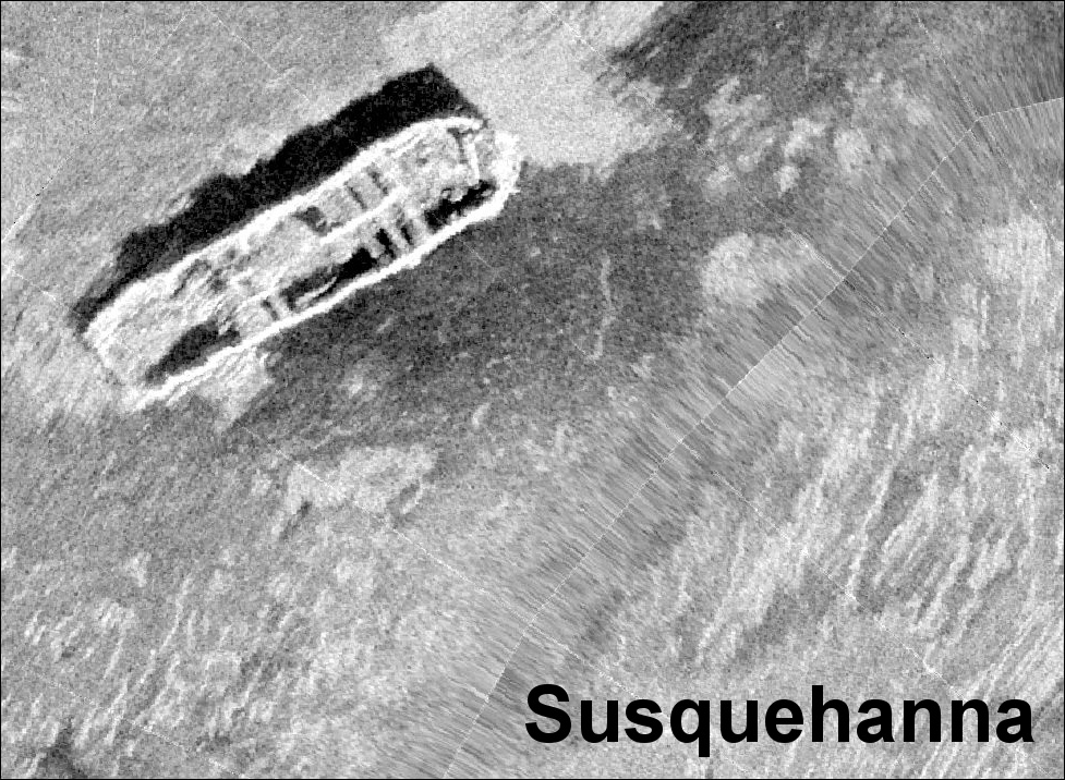
Pennsylvania’s Lake Erie waters have a rich maritime history with dozens of known shipwrecks and many more yet to be discovered. The Coastal Resources Management (CRM) Program collects geopositional data, side scan sonar imagery, and underwater video on Lake Erie shipwrecks to map their locations and document their conditions. CRM is currently developing a story map using the data and information collected over the past several years to highlight Pennsylvania’s maritime history and provide the public with information and imagery to which they do not normally have access. The story map would allow the public to see general information about each wreck, including the locations of non-sensitive wreck sites, type of vessel, cargo, cause and date of loss, and any associated loss of life. The user would be able to view side scan sonar images and mosaics of a wreck site, displaying a representation of the wreck, its physical setting, and debris fields. Finally, the user would be able to link to a short underwater video of the wreck site, recorded with a Remotely Operated Vehicle (ROV), and edited to highlight interesting features and aquatic life. Data and information collected by CRM contributed to the nomination and acceptance of Pennsylvania’s Lake Erie waters (the
Lake Erie Quadrangle) into NOAA’s National Marine Sanctuary Inventory for consideration to be designated as a new National Marine Sanctuary.
Coastal Zone Aerial Photography
The program maintains a large inventory of digital and film historical aerial photography of the Lake Erie and Delaware Estuary Coastal Zones in vertical and oblique formats.
This link provides more details and downloads of the most recent years of photography completed by the program.